Drones vs. Satellites for Moorland Vegetation Mapping: A Practical Comparison
A vegetation map of a moor is only useful if it answers the question you actually asked. If you need to know whether bracken is creeping into a heather stand, a ten-metre satellite pixel is too blunt an instrument. If you want to know how 400 hectares of peatland has recovered since the grips were blocked, hiring a drone pilot is an expensive way to find out. These two platforms are not rivals so much as tools at different scales, and most moorland projects end up using both.
Resolution: the difference in practice
Free satellite imagery has improved to the point where it is genuinely useful for land management. Sentinel-2 delivers optical and near-infrared bands at 10 to 20 metres per pixel, with a revisit roughly every five days because two satellites are in orbit. One 10-metre pixel covers 100 square metres — about the footprint of a modest garden. That is fine for mapping a large block of heather, or tracking a bracken front across a hillside over several years. It struggles with the fine-grained mosaic that makes moorland interesting: scattered birch scrub, narrow flushes, a two-metre-wide erosion gully, or a patch of dying heather forty metres across.
Commercial satellites sharpen this considerably, with sub-metre to three-metre products available. You pay for the privilege, the swath is narrower, and you often need to order a tasking rather than pull an image from a free archive. For one-off, site-specific work it can be a reasonable middle path.
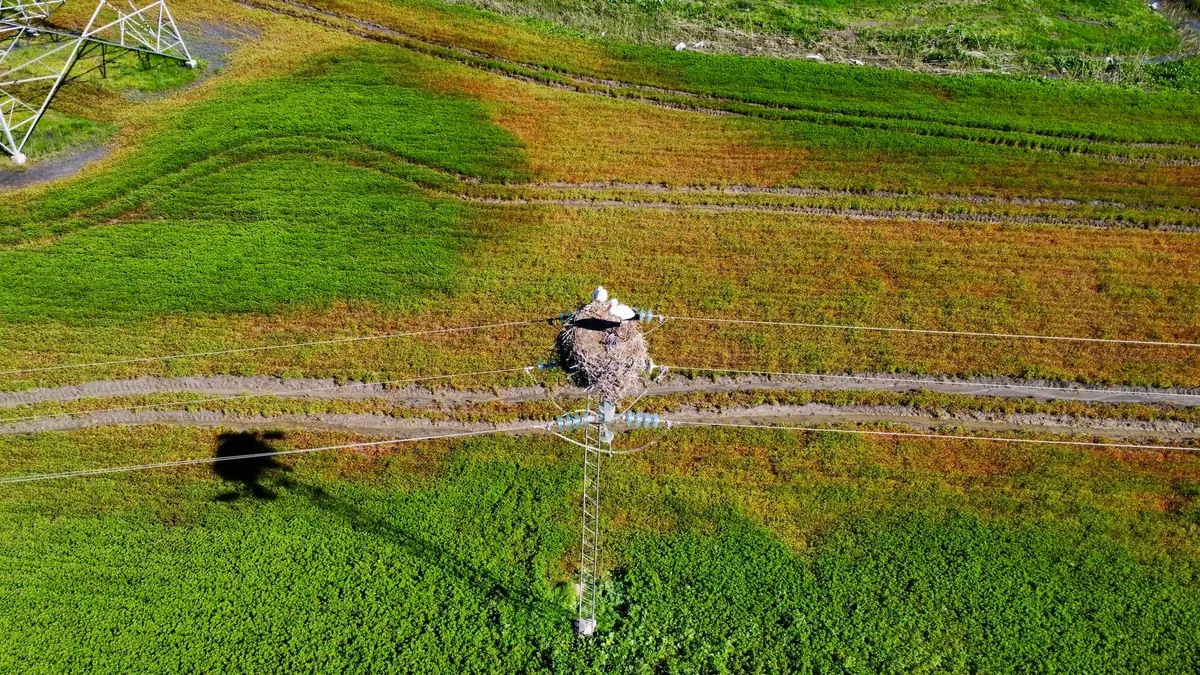
Drones sit at the other end entirely. Fly a small quadcopter at 60 to 80 metres with a decent camera and you get pixels measured in centimetres rather than metres — often one to three centimetres. A single bracken frond, the lip of a peat hag, the boundary between burnt and unburnt heather: all visible. Add RTK or PPK positioning, or lay out ground control points, and the resulting orthomosaic can be tied to the national grid accurately enough to compare with a survey from three years ago.
What multispectral sensors actually add
Near-infrared and red-edge bands help separate green vegetation from bare ground, and they underpin indices like NDVI. Satellite platforms give you these bands for free. Drone-mounted multispectral sensors do too, at a price. What they do not do is tell heather from bracken when both are green — for that, timing matters far more than band count.
Cost: where the money really goes
Satellite data is the cheap part. Sentinel-2 and Landsat imagery is free; the cost is the analyst's time and, if you use a commercial product, a per-scene fee. Drone surveys carry a longer list of expenses, and the aircraft is rarely the largest one:
- Airframe, spare batteries, props and a case — plus the reality that moorland is hard on equipment
- Sensor: an RGB camera is often enough; multispectral adds a significant premium
- Positioning: RTK module or ground control points, either of which costs time or money
- Pilot competence and insurance, whether in-house or contracted
- Processing software, usually a subscription
- Staff days for flying, processing, classifying and validating
If you need one map every three years, contracting a survey company is usually cheaper than buying a setup and maintaining the skills to use it. If you fly monthly across several sites, in-house capacity starts to pay. Drone rules vary and site designations can add consent requirements, so check current regulations and take professional advice before committing.
Weather and timing on real moorland
This is where the free data gets frustrating. A five-day revisit sounds generous until you count usable scenes. Uplands are cloudy, and a wet winter can leave months of gaps in the archive. You cannot ask a satellite to wait for a clear afternoon.
Drones fly below cloud base, which is a genuine advantage in a British or Irish upland context — flat overcast light is perfectly workable as long as it is even. Wind is the real limit. Small aircraft are comfortable up to roughly eight to ten metres per second, and exposed ridges and summits frequently exceed that. Rain, mist and cold all shorten battery life and degrade image quality.
Season matters as much as weather. Bracken is easiest to map in late summer and early autumn, when fronds senesce and turn a distinctly different colour from the surrounding grass. Heather in flower, usually August into September, is the moment it separates most cleanly from grass and rush. Bare peat and erosion features show up best in late winter and early spring, before vegetation grows up — but that overlaps the nesting season, so plan around bird disturbance. A drone lets you pick the day. A satellite gives you whatever it gives you.
Bracken, heather and peat: which platform suits which job
Bracken
Bracken spreads by rhizome, so the advancing edge matters more than the solid middle. Satellite imagery at ten metres tracks the main stands and their movement over years quite adequately. Drones earn their place when you are planning treatment: pinpointing small outliers, checking a compartment before spraying or rolling, and confirming what actually died back afterwards. Late-summer imagery does most of the classification work for you.
Heather
Satellite data resolves stand-scale patterns of building, mature and degenerate heather, which is enough for burn rotation planning across a large estate. Heather beetle damage is a different problem: grey patches appear within stands and spread. Early detection at that scale usually needs drone imagery, and small burnt patches can disappear entirely inside a coarse pixel.
Peatland
Many peatland features of interest — gullies, hags, peat pipes, open drains, Sphagnum pools — are narrower than a satellite pixel. Drones capture them, and structure-from-motion processing produces a centimetre-scale surface model you can use to estimate erosion volumes or check whether a reprofiled hag is holding. Satellites remain the better tool for whole-estate condition monitoring and long-run change detection after restoration.
Ground truth decides more than the sensor
No sensor knows what species it is looking at. Every classification rests on training data: GPS-tagged plots where someone stood and recorded what was there. A drone map validated against forty ground plots will outperform a satellite map with none, and will be more defensible if a funder or regulator asks how you know. Record flight dates, sun angle and sensor settings alongside the imagery, because comparing a July flight with a February one is rarely meaningful.
A practical way to choose
- Define the smallest feature you need to detect. If it is under about five metres across, satellites alone will not do it.
- Decide how often you need an answer. Annual or multi-year monitoring points to satellite; a one-off detailed survey points to a drone.
- Check your seasonal window. If the only usable period is a narrow fortnight, a drone gives you control that an overpass cannot.
- Cost it honestly, including your own time. Processing and validating drone data takes longer than flying it.
- Start with the free option. Pull the Sentinel-2 archive for your site and see how far it gets you before spending anything.
The workable pattern for most moorland managers is satellite imagery as the baseline and the annual record, with drone surveys reserved for priority sites, treatment planning and anything where the detail genuinely changes a decision. Buy the resolution you will use, not the resolution that sounds impressive.
Photo: TimHill / Pixabay